Mobile GIS
EFFETRESEIZERO Ltd performed software for mobile GIS, especially in forestry sector, as follows:
|
Point SYS Point SYS, called “methodical sampling”, is a Python script of ESRI ArcGis that sets the coordinates in the sampling. With this method, the objective criterion called statistics sampling, and the homogeneous distribution of points in layers are respected. With the creation of a regular grid of points assimilated to the sampling intensity, it is possible to find the plot of sampling in each layer.
|
 |
|
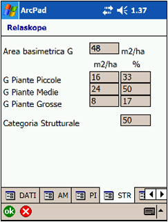
Relaskope Relaskope is an Applet for Arcpad 7.0.1 that registers data about the sample plot of stand. Editing the layer, for the sample plot it is possible to:
|
 |
|
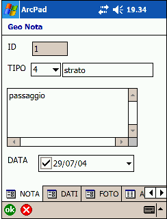
Geonote Geonote is an Applet for Arcpad 7.0.1. The field survey is simplified because textual notes are georeferenced with numerical attributes. Editing the layer, it is possible to classify the point with denomination and symbols. Differently from the types of Geonota, it is possible to insert:
|
 |
|
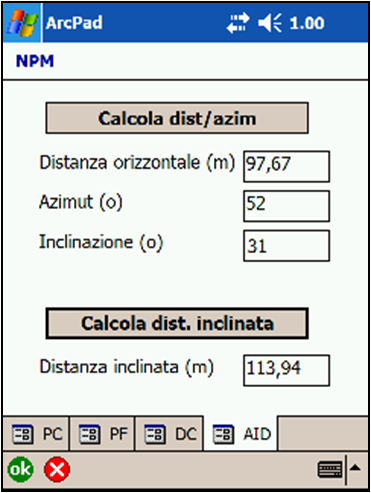
NPM NPM (“Navigation with average position”) is an Applet for Arcpad 7.0.1 that assist in sample plot surveys based on relascopic measurements. By the average position with a GPS, NPM lets to obtain the inclined distance and the azimuth from the sample plot. |
 |